Mineral Resources
Mineral Resources
Geology and topography have played an important role in the development of Leeds and its surrounding area. Sandstones suitable for all types of construction, clays for brick making, coal for fuel and minerals for iron making were all readily available locally. The rivers Aire and Calder and their tributaries, flowing in narrow, steep sided valleys, provided water for power, industrial processes and as means of transport for raw materials and products.
Sandstones
The site of Kirkstall Abbey, one of the oldest buildings in Leeds, was selected partly due to nearby outcrops of the Rough Rock, one of the gritstones, typical of the Millstone Grit Group, which was used for its construction.
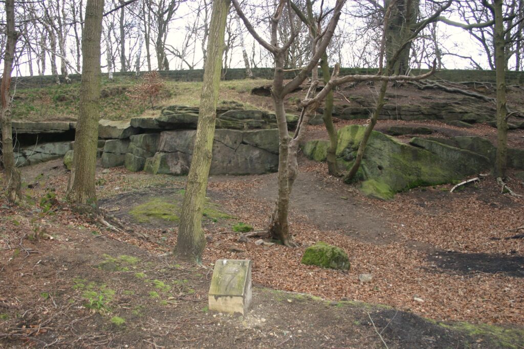
Figure 1 – A small quarry in Millstone Grit Group, Rough Rock gritstones, Roundhay Park
As industry developed and towns and villages expanded many small quarries (Figure 1) were opened close to the place where the stone was required but, by the mid-nineteenth century, as demand increased and mechanisation and better transport were introduced, these were replaced by fewer, larger quarries (Figure 2).
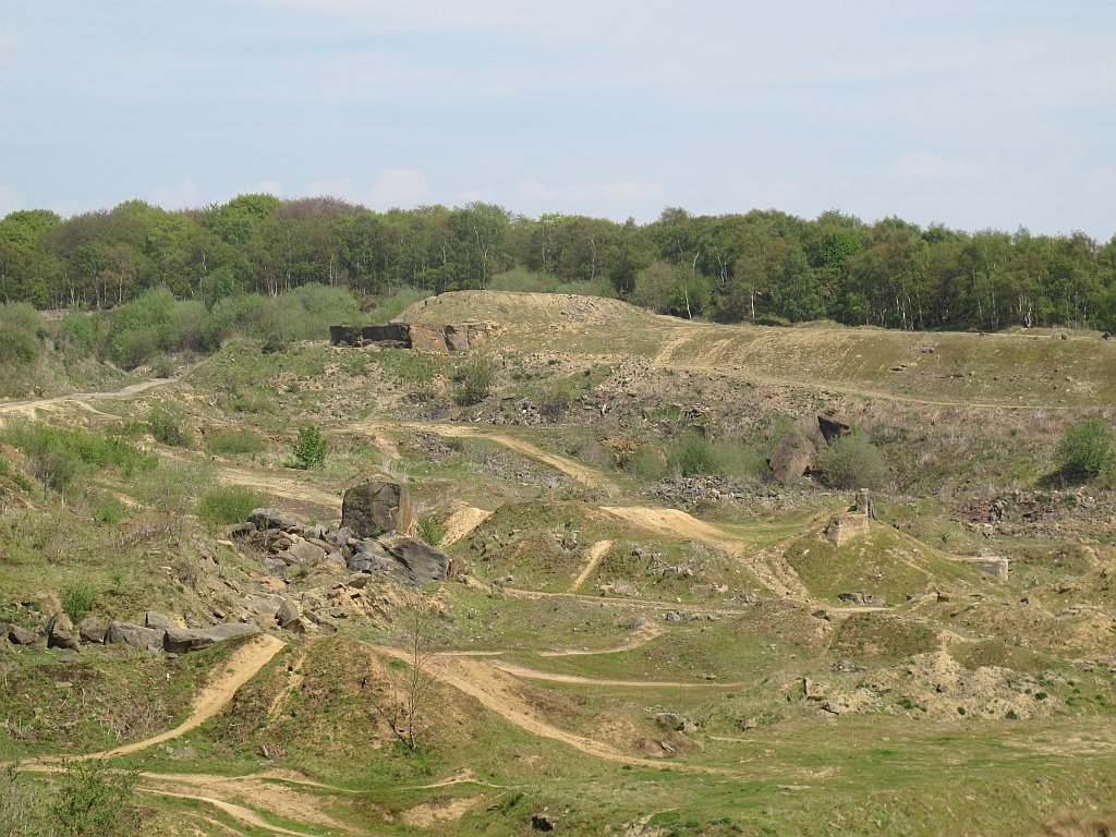
Figure 2 – A large quarry in Millstone Grit, Rough Rock gritstone. Woodside Quarry, Horsforth
The Millstone Grit Group sandstones are strong, coarse to medium-grained and occur in thick beds, making them ideal for building and engineering purposes. Their coarse nature however meant they could not be used where a smooth finish was required or for finely carved, decorative work. For this type of work the Coal Measure Group sandstones, which are generally medium-fine grained, were used. Some of these sandstones were flagstones, that are easily split into thin slabs making them ideal for paving and roofing. Many of the older civic and commercial buildings in Leeds, of which Leeds Town Hall (Figure 3) is an excellent example, show a combination of large blocks of coarse-grained sandstones forming their basal layers with fine grained sandstones, often with ornate carvings, comprising their upper portions.

Figure 3 – Leeds Town Hall. Large blocks of coarse-grained gritstones have been used for the lower courses with smaller blocks of finer grained sandstones for those above where a smooth finish and decorative work was required
Stone was not just used locally but exported to other parts of the country and abroad. The Rough Rock was particularly sought after and stone from Bramley Fall Quarries (Figure 4) was used for many important projects. Notable ones were the original Euston Station and Millwall Docks in London and docks in Mumbai, India.
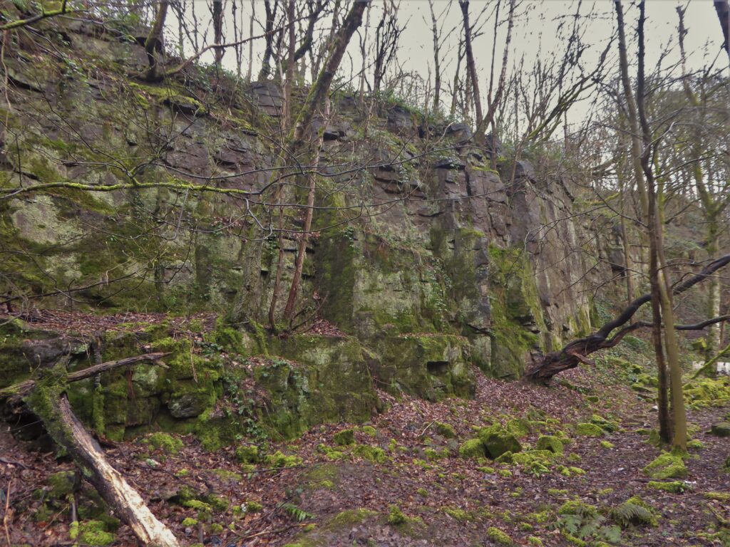
Figure 4 – Bramley Fall Quarries supplied stone for many prestigious buildings and structures at home and abroad
Today there are still some quarries producing dimensional sandstone today (Figure 5). Much of the quarried stone is used in the restoration of, or extensions to, older buildings.
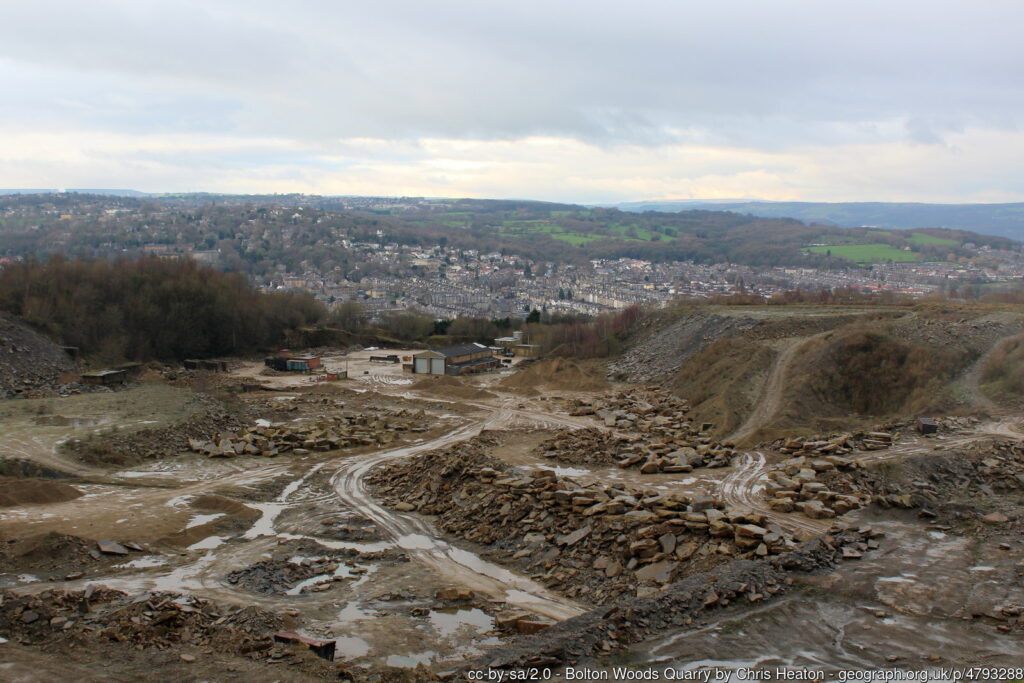
Figure 5 – Bolton Woods Quarry Bradford which still produces dimensional stone
Being relatively soft, well sorted and made of almost pure quartz, the Permian age, desert sands of the Yellow Sands Formation, were mined in the past around Garforth, Castleford, Glasshoughton and Pontefract. The extracted sands were used as for moulding sand in the iron industry and for glass making.
Coal
Coal has been mined in the Leeds district, possibly since Roman times. The occurrence of abundant and easily accessible reserves across the southern part of the district was vital to the growth of its industries and population. Steam replaced water power in the woollen mills that had grown along the Aire and Calder valleys and their tributaries. Steam then provided the power to enable mines to reach deeper reserves and for the transport to convey their products. Initially coal was dug from shallow open pits where it outcropped or was close to the surface. As these shallow reserves were exhausted the coal seams were followed underground, accessed by deeper and deeper mines. Since the 1940’s the increasing costs of deep mining and improvements in machinery saw a move to large scale opencast mines (Figure 6).
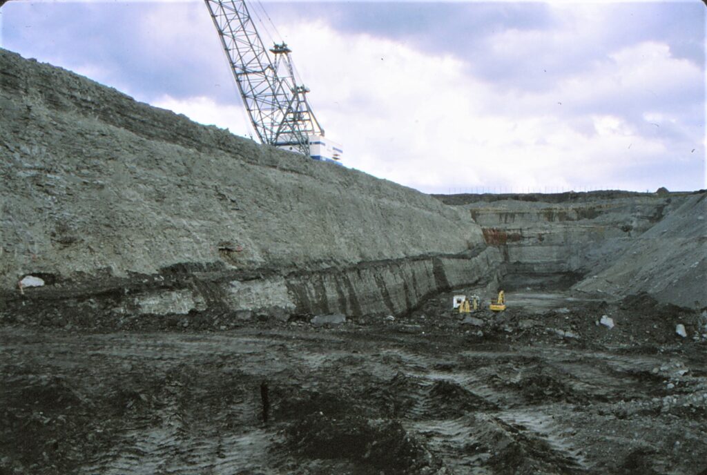
Figure 6 – St Aidan’s Opencast coal mine. Astley. Leeds. This site closed in 2002 and was restored and is now a large RSPB nature reserve
All mining has now ceased in the district and much of the evidence of its existence has been cleared away. An exception to this is Caphouse Colliery which is now the National Mining Museum. This museum provides an insight of this once great industry and includes underground experiences for visitors.
Mudrocks and Clays
Brick took over from stone to satisfy the growing demand for houses during late Victorian times. Brick was a much cheaper alternative than stone and the mudrock and clay required to manufacture bricks were readily available in the Coal Measure Group and Quaternary rocks. The Coal Measures Group rocks also supplied the coal to fire the kilns. Clays were also used for making pottery and terracotta tiles. The best known potteries where the Leeds Pottery, which made white ‘Leeds Creamware’, and the Burmantofts Pottery, which made coloured, glazed tiles and bricks known as ‘faience’ (Figure 7).

Figure 7 – Burmantofts Pottery. Leeds
As in stone quarrying, initially there were many small clay pits and kilns which opened adjacent to where the bricks were required but these were replaced by larger operations as mechanisation and transport improved. Today these industries have all but disappeared although there are quarries where reserves have been mothballed.
Ironstones
Ironstones occur in the mudrocks of the Coal Measures Group, either as thin beds or nodules. These deposits were dug from quarries and mines and provided the raw material for the iron industry that Leeds became famous for. However, the reserves of ironstone were limited, and it was not long before they were exhausted, meaning ore had to be imported from elsewhere.
Limestone
The Permian age limestones in the east of the district were worked from many quarries along its outcrop (Figure 8), primarily for building stone and for burning to make agricultural lime.

Figure 8 – Abandoned limestone quarry. Micklefield
As well as used for building in villages such as Wetherby, Bramham and Aberford, (Figure 9) its attractive pale-yellow colour, ease of extraction and ability to take fine carving made it worth transporting considerable distances in the past. York Minster was largely built of stone from a quarry near Sherburn, and it was also used in the construction of Eton College. The same rock, but from quarries in South Yorkshire, was used to build the Houses of Parliament. Today the main use of this stone is for aggregate.

Figure 9 – Aberford Almhouses. Built of local dolomitic limestone
Sands and Gravels
The youngest geological materials are those left by melting ice at the end of the Ice Age. Meltwater rivers surging through the Calder, Aire, and Wharfe valleys, and the lakes that once flooded their lower reaches, left thick accumulations of sands and gravels which were dug from open pits as aggregates for the construction industry. Much of this work has now stopped and the flooded quarries (Figure 10) are used for recreation or as wildlife reserves.
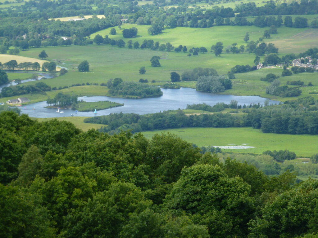
Figure 10 – Flooded gravel pits used for sailing, Otley
Water
Traditionally the bulk of the district’s public water came from reservoirs with the rest from rivers and boreholes. However, with the development of a connected water grid system it can now be transferred from sources much further away. Reservoirs are mostly sited on rocks of the Millstone Grit Group to the north and west of the district with water being transferred to the urban areas by a combination of the rivers that flow from them and pipelines.
Boreholes exploiting water held in porous rocks below the surface (aquifers) mainly supply individual industrial and agricultural customers. In areas underlain by Carboniferous rocks, sandstones of the Millstone Grit Group form the best aquifers as their water is generally of better quality than that extracted from sandstones of the Coal Measures Group. The Permian limestones in the east of the area form good aquifers but the water is ‘hard’ (meaning it has a high dissolved mineral content). One advantage of this hard water is that it makes good beer – which accounts for the breweries in Tadcaster!
